

The National Weather Service in Mount Holly is predicting widespread showers and thunderstorms to affect our region this afternoon (7/31) and tonight. Not everyone will necessarily see heavy rain, but there is the potential for some in our area, including here in Avalon, to see storms with rainfall rates in excess of 2 inches per hour. The forecast currently calls for rainfall totals generally in the range of 1 to 3 inches, with localized amounts of 5 to 7 inches.

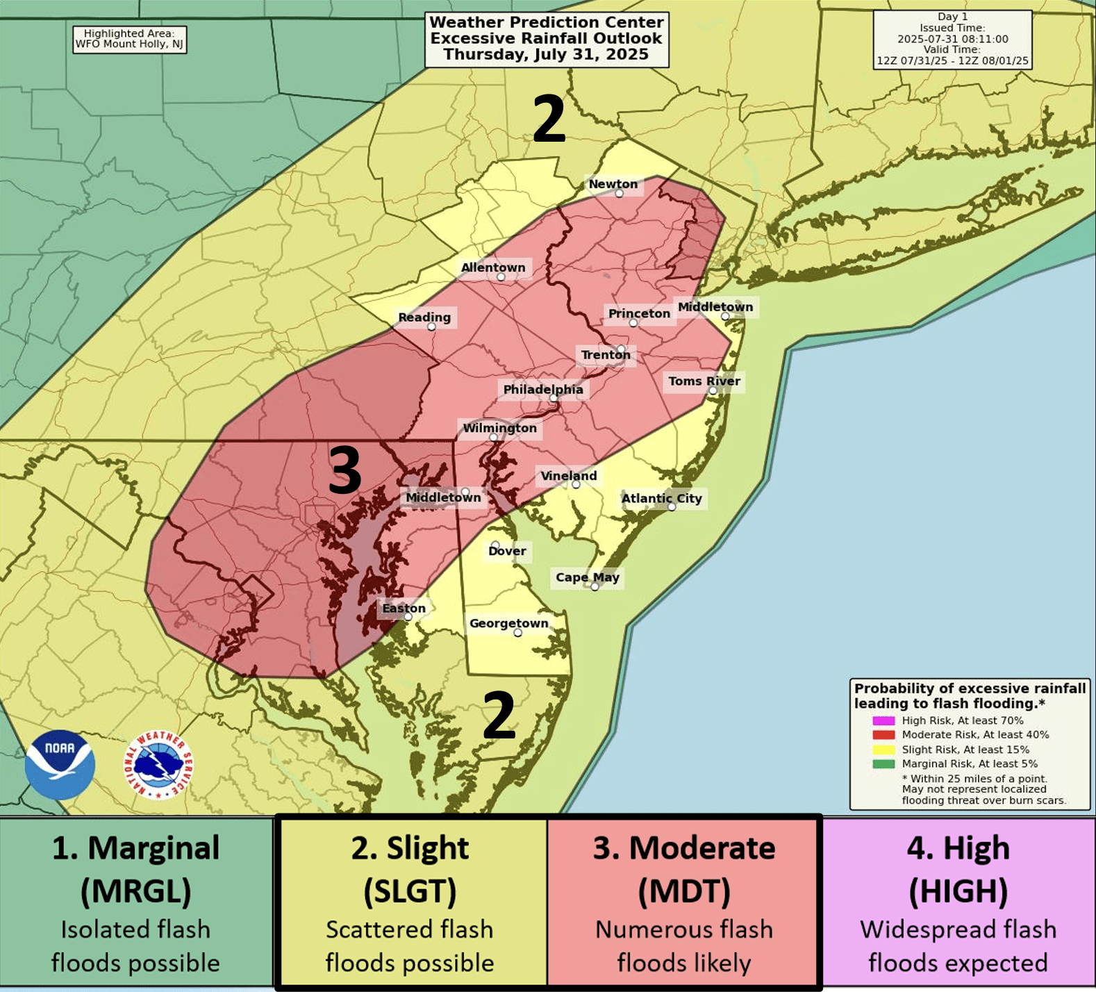
Avalon and Cape May County are in a Slight Risk zone, which means that scattered flash floods are possible. Areas closer to I-95 are in a more serious Moderate Risk zone. Parts of our region are also in a Marginal Risk zone for severe thunderstorms, which indicates that they will likely be isolated in nature, though the towns along the immediate coast, including Avalon, are forecast not to receive any severe storms.
As a result of this forecast, our entire area is under a Flood Watch from 2pm today through 6am Friday. Locally damaging winds and heavy rain are the main threat from this system. Remember that flooded roads should be avoided, as the water can be deeper than it seems, and that if you hear thunder you should head indoors. On the plus side, the storms will usher in cooler and less humid weather for the weekend.
[EDIT: 7/31/25 @ 1:39PM]: A Severe Thunderstorm Watch has been issued for Avalon and Cape May County. It will be in effect until 8pm tonight. This means that conditions are favorable for severe thunderstorms to develop, but does not guarantee that they will occur. While it may remain dry in your specific location, storms will likely form in our area, so remain alert for signs of inclement weather.


